
It didn’t take long to settle into Champagny-en-Vanoise, a tiny town far from popular French destinations like Paris and Nice. Our home base was a cozy condo, high in the Alps, with close proximity to the local coffee shop, pizzeria, bar, market, bakery. And, it had stunning 360 degree views from the deck.
As much as we loved our condo and our location, we were ready to fill our packs and head out on a three-day hike through the Alps.
We thought we had the logistics completely dialed in. Since the trailhead was several miles from town, we planned to hike down to the coffee shop (always a great place to start an adventure)) and ask Clementine, our favorite barista, to call the village’s only taxi for a ride to the trailhead. That was Plan A, and it failed instantly. The taxi was busy until noon; too late to start our hike.
We quickly switched to Plan B, which was simple, just less efficient. We’d get the car and drive to the trailhead, then taxi back to our car in a few days. Simple. Dan walked to the house to get the car, and in the fifteen minutes it took him to return, an unexpected Plan C was well underway.
Clementine had asked Louie, one of the summer regulars, to drive us to the trailhead, and he accepted with a giant grin. Since the entire conversation transpired in French, we were unaware of the arrangement until Clementine proudly announced she’d found us a ride.
So, Dan took the car back to the house, we piled into Louie’s ride, and set off for the Le Laisonnay trailhead, where Louie pointed us in the right direction and waved goodbye.
Day One
Le Lasonnay to Refuge Col du Palet
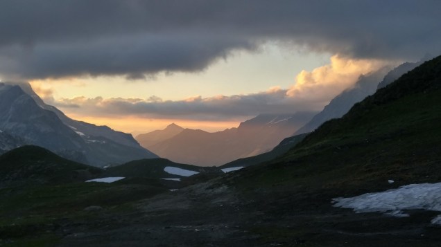
 We started our adventure with an easy 7-mile hike to Refuge Col du Palet, which, at 2,587 meters, is one of the highest huts in the Vanoise National Park. The trail wandered past Refuge Les Gliere, then climbed up and over the Col du Palet through lush fields bursting with wildflowers and stunning peak views.
The rustic hut was perfectly placed in a meadow overlooking a lake and shadowed by towering peaks. We shared our dinner table with Vic And Sandra, a couple from Britain on a 12-day trek along the Grande Randonnee 5 route (GR5 route), and our bedroom with a dozen strangers (which was fortunate since the room was set up to accommodate 32 hikers, 16 in lower beds and 16 in the bunks above). We were happy we were assigned lower beds, and even happier that not one of our roommates snored.
____________
Day 2
Col du Palet to Refuge de La Leisse

The day’s 10-mile trek started with an uninspiring walk to and through Tignes, a new ski village comprised of high rise condos, and morphed into a spectacular stroll in the shadow of Mont Blanc. We zipped over rolling hills and through meadows of lush wildflowers, and then we hit the snow zone.
Col de la Leisse, at just over 9,000 feet, was the day’s highpoint, and the remnants of the snowy winter were apparent as we gained altitude. We slipped and slid as we crossed snowfields, but the slower pace gave us a chance to admire the glaciers hanging onto the peaks surrounding the valley.
We made it to the Refuge de la Leisse in early afternoon with plenty of time to shower and drink a beer before dinner. Vic and Sandra, our friends from the Refuge Col Du Palet beat us there, so we swapped stories before dinner. And we also met twin sisters Sanna and Lina from Sweden who were training for upcoming high-altitude running races.
We shared a room with six strangers, and sadly, it was a much noisier night, with a symphony of snores and coughs which kept us up into the wee hours.

____________
Day 3
Refuge de la Leisse to Pralognon

Our final hike was a picture-perfect, 12-mile trek along clean dirt trails to Pralognan, a village down valley from Champagny-en-Vanoise, where we hoped to catch the 3:00 bus for the short ride back to our village.
We took advantage of the scenic, sun-drenched day to enjoy changing views along raging rivers, under glaciers, and through meadows. The miles flew by, especially once we lost altitude and left the snow behind.
Like clockwork, we made it to Pralognon with just enough time to catch the bus, and all too soon, we were back in Champagny en Vanoise.
The next morning started, as usual, at our favorite coffee shop. And guess who beat us there for his morning coffee? Louie! Our favorite Frenchman welcomed us back with broad grins and big hugs.

 If you plug Frazione-Capoluogo, 47 Valpelline, Aosta Valley, Italy into Google Maps, you’ll end up in the tiny village of